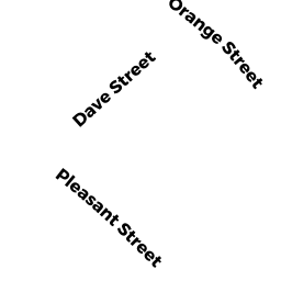
12 DAVES ST
Owner Information
RPN LLC
12 DAVES ST
NANTUCKET, MA 02554


Property Details
12 DAVES ST is classified as a Restaurant/Clubs M01 (Nightclub/bar).
The primary structure on this property was built in 1950. There are 5,369ft2 of built area within this property. There is 4,287ft2 of residential/living space within this property.
12 DAVES ST is valued at $1,691,000. The land is valued at $886,300 and the structures are valued at $801,000. There is an additional valuation of $3,700 on this property.
This property is in Zone CMI. Confirm with local Zoning Board authorities to ensure there are no overlays or other easements on this property.
The most recent deed for 12 DAVES ST is recorded at the local registrar in Book 00660, Page 0194. 12 DAVES ST was last sold on Wednesday, May 10, 2000 for $1,310,000.
Assessment data from fiscal year 2022.
Flood Data
According to the FEMA National Flood Hazard Layer, this property does not appear to be in a flood zone. It may also be in an area not yet reviewed. Nonetheless, confirm this information prior to taking any action.
To view the flood hazards around this property, create a FEMA "Firmette" Map of the area around 12 DAVES ST.
Broadband Internet Providers
| Provider | Type | Bandwidth (mbps) | |
|---|---|---|---|
| GCI Communication Corp. | Satellite | 0 | 0 |
| Comcast | Cable | 1000 | 35 |
| Verizon New England Inc. | DSL | 15 | 1 |
| HughesNet | Satellite | 25 | 3 |
| Viasat Inc | Satellite | 35 | 3 |
| VSAT Systems, LLC. | Satellite | 2 | 1 |
Broadband service provider data from December 2020.
Adjacent Properties
- 8 DAVES ST
Developable Residential Land owned by JEMISON STEVEN - 122 PLEASANT ST
Discount Stores, Junior Department Stores, Department Stores owned by BELL ALLAN D & BONITA L - 4 CHINS WY
Parking Lot M00 owned by BONITA BAR LLC - PLEASANT ST
Vacant, Selectmen or City Council (Municipal) owned by NANTUCKET TOWN OF